
GIS Tips & Tricks
From getting started with ArcGIS Online to creating map layouts in ArcGIS Pro, the CGIS team has you covered.
Learn MoreWe work collaboratively with partners to identify, analyze and better understand data to enhance information access, deliver new insights and utilize technology to inform business challenges and decisions.
The Center for GIS specializes in empowering our clients to make the most of their data, and developing interactive maps and data-driven displays that are robust, accessible and intuitive. We provide a full range customized geospatial solutions, including GIS application development, geospatial data development and analysis, and tailored GIS training.
Everything happens somewhere. GIS, or geographic information sciences, uses maps and databases to leverage the where aspect of data.
We believe in the power of GIS technology to answer complex questions and continually work to extend the accessibility and value derived from GIS technology. We work to:
CGIS is staffed with a team of highly qualified technologists who produce products and services that are both useful and technically sound. We work cohesively as equals and commit our energy toward collaborative, creative work. We are proud of the quality of our work and believe that the results of our work can and should contribute to the greater good.
In 1992, under the direction of Dr. John M. Morgan, III, Towson University’s Department of Geography and Environmental Planning GIS Lab became the Center for Geographic Information Sciences (CGIS), a professionally staffed business unit devoted to serving the rapidly growing need for applied GIS services.
As Maryland’s geospatial efforts advance and mature, so do our relationships.
State Agencies
The Center for GIS has a long and continued history of collaborating with Maryland State agencies such as the Maryland Transit Administration, Maryland Department of Health, Maryland Department of Agriculture, and Maryland Department of Commerce. We build applications and maintain spatial data that help our partners meet their objectives around environmental stewardship, health and safety, and providing accessible resources to the public.
TUgis: Maryland's Geospatial Conference
TUgis is the largest gathering of GIS professionals in the region. TUgis: Maryland’s Geospatial Conference is a cooperative undertaking of MSGIC, DoIT, and Towson University.
Maryland’s Geographic Information Office
In efforts to promote collaboration and coordination in Maryland, Towson University works closely with Maryland’s Geographic Information Office within the Department of Information Technology (DoIT), to support GIS activities of state agencies, including application development, geospatial analysis, professional development and training services.
MSGIC
CGIS has worked with the all-volunteer Maryland State Geographic Information Committee (MSGIC) on several National Spatial Data Infrastructure Cooperative Agreement Program projects to coordinate the development and delivery of geospatial resources in Maryland, the region, and nationally.
From getting started with ArcGIS Online to creating map layouts in ArcGIS Pro, the CGIS team has you covered.
Learn More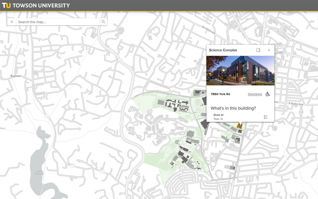
Discover accesibility tips, including highlights from a recently redesigned web map of TU's campus.
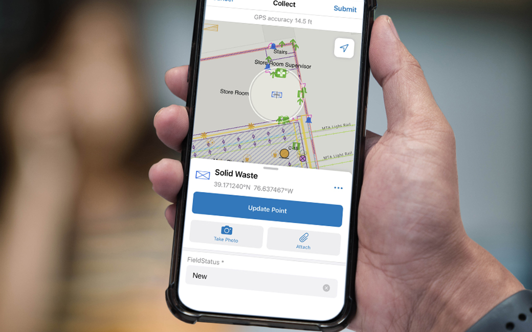
CGIS used ArcGIS Field Maps to update environmental and safety data at MTA maintenance facilities.
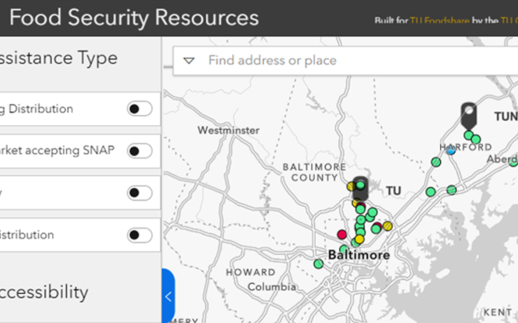
CGIS and the Basic Needs Hub showcase collaboration to create the interactive TU Food Security Map.
401 Washington Avenue
Towson, MD 21204